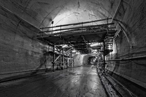
Every construction site hides a complex world beneath the surface. Water lines, gas pipes, electrical cables, communication networks, and aging infrastructure often sit just inches below where excavation begins. When these systems are poorly documented or inaccurately located, the results can be dangerous – from gas leaks and power outages to serious injuries and environmental damage. That’s why underground utility mapping has become a foundation of modern safety planning.
Accurate subsurface data doesn’t just make projects run smoother. It protects lives, prevents disasters, and allows cities and companies to build with confidence.
The hidden risks below construction sites
Striking an underground utility is more common than many people realize. Contractors frequently encounter unknown pipes or cables that were never recorded properly, installed decades ago, or shifted over time due to soil movement. Even small errors in location can result in heavy machinery tearing into pressurized gas lines, electrical conduits, or water mains.
These incidents can trigger explosions, flooding, service shutdowns, and serious worker injuries. Beyond immediate danger, utility strikes often cause long project delays, legal disputes, and expensive repairs.
The challenge is simple: you can’t protect what you can’t see – and guessing underground locations is never enough.
How mapping improves worker and public safety
Accurate underground utility mapping creates a clear picture of what lies beneath a site before excavation begins. Using advanced non-invasive detection technologies, specialists locate and document buried infrastructure with precision.
This information allows project teams to:
- Plan excavation routes safely
- Adjust equipment placement and depth
- Avoid high-risk zones
- Coordinate with utility providers in advance
- Reduce emergency shutdowns and repairs
When crews know exactly where utilities run, they can work confidently instead of cautiously guessing. That clarity lowers accident rates, minimizes interruptions, and keeps both workers and surrounding communities safer.
Preventing chain-reaction failures
Utility strikes don’t just damage one pipe or cable. They often trigger cascading problems.
A ruptured water main can erode soil and weaken road foundations. A cut power line can disrupt hospitals, transportation systems, and communication networks. Gas leaks can force evacuations and pose long-term environmental risks.
Accurate mapping prevents these domino effects by eliminating blind digging. When underground systems are respected and avoided, entire infrastructure networks remain stable.
Reducing reliance on outdated records
Many cities and utilities still rely on old drawings, incomplete documentation, or handwritten maps created long before modern digital systems existed. Over decades of repairs and expansions, actual utility locations frequently drift away from what records suggest.
Modern mapping replaces assumption with real-world detection. Rather than trusting paper plans, project teams can verify current conditions beneath the surface. This approach dramatically lowers the chance of unexpected encounters during excavation.
Supporting safer project planning
Safety starts long before heavy equipment arrives. With accurate subsurface data, engineers and planners can design projects around existing infrastructure instead of reacting to surprises.
This enables:
- Safer trench layouts
- Better drainage and soil stabilization
- Lower risk of structural settlement
- Fewer emergency field decisions
In the middle of project planning, many organizations now rely on accurate utility mapping services to ensure that underground hazards are identified early and addressed properly. This proactive step often determines whether a project runs smoothly or becomes a costly safety challenge.
Technology paired with human expertise
Advanced tools such as ground penetrating radar, electromagnetic detection, acoustic imaging, and digital modeling provide incredibly detailed subsurface insights. But technology alone isn’t enough.
Interpreting underground conditions requires experienced professionals who understand soil behavior, infrastructure aging, moisture interference, and complex urban environments. Skilled specialists know how to differentiate between real utilities, natural formations, and signal noise – turning raw data into reliable maps.
This blend of innovation and expertise is what allows modern mapping to deliver dependable safety outcomes.
A proactive approach to infrastructure protection
Rather than waiting for accidents to reveal underground problems, many municipalities and utility operators now integrate regular mapping into maintenance programs. Periodic assessments help track shifting soil conditions, aging pipes, and undocumented modifications before they become hazards.
This long-term strategy reduces emergency repairs, improves worker safety, and extends the lifespan of underground systems.
Building safer cities worldwide
Urban growth continues to intensify pressure on underground infrastructure. Transportation expansions, housing development, utility upgrades, and climate-related soil changes all increase the likelihood of underground conflicts.
Companies like MAYA Global Group have spent decades advancing underground detection and mapping across diverse environments – from dense city centers to challenging terrains worldwide. Their experience in large-scale infrastructure projects demonstrates how accurate subsurface knowledge directly translates into safer construction practices and more resilient communities.
Conclusion
Accurate underground utility mapping is not just a technical step in construction – it’s a fundamental safety measure. By revealing hidden infrastructure before excavation begins, mapping prevents accidents, protects workers, avoids service disruptions, and reduces long-term infrastructure damage.
As cities expand and underground systems grow more complex, relying on assumptions becomes increasingly dangerous. Proactive detection, precise mapping, and expert interpretation allow projects to move forward with confidence instead of risk.
Understanding what lies beneath the surface is one of the most effective ways to keep people safe above it.